How drone data moves from flight to delivery with a full-service capture model
When a drone finishes its flight and lands, the real work often begins. The raw images and sensor data stored on the memory card are only the starting point. For professionals who rely on aerial information for surveys, inspections, or mapping, the challenge is turning that raw data into something usable. This is where the concept of a full-service capture model comes in. It is a way of handling the entire chain from piloting the drone through to delivering processed, organized data. Understanding how this process works helps anyone who buys or uses aerial data know what to expect and how to evaluate a service provider.
What a full-service capture model means in practice
A full-service capture model essentially bundles the drone flight and the data processing into a single package. The customer does not have to worry about stitching images, aligning point clouds, or calibrating sensors. Instead, they receive finished products like orthomosaics, 3D models, or inspection reports. This approach shifts the responsibility for technical expertise from the end user to the service provider. For many industries, this is a significant advantage. A construction manager overseeing a large project does not need to become a drone pilot and a photogrammetry specialist. They need accurate, up-to-date information about site progress. The full-service model delivers that without requiring the customer to invest in expensive software or training.
The process typically starts with a clear brief. The customer specifies what they need: a map with a certain resolution, a thermal inspection of a roof, or a volumetric calculation of a stockpile. The service provider then plans the flight to meet those requirements. This planning stage is critical. It determines the flight altitude, the overlap between images, the sensor settings, and the ground control points needed for accuracy. A well-planned flight reduces the amount of post-processing work and ensures the final data meets the required standards. This upfront work is invisible to the customer but directly affects the quality of the delivered product.
From flight to data: the capture stage
Once the plan is set, the actual flight takes place. Modern drones can carry a variety of sensors beyond standard RGB cameras. Multispectral sensors capture data in specific wavelengths useful for agriculture and environmental monitoring. Thermal cameras detect heat signatures for building inspections or search and rescue. LiDAR sensors produce precise 3D point clouds even through vegetation. The choice of sensor depends entirely on the application. A single flight might capture hundreds or thousands of images, each with embedded GPS coordinates and altitude data. This metadata is essential for the processing steps that follow.
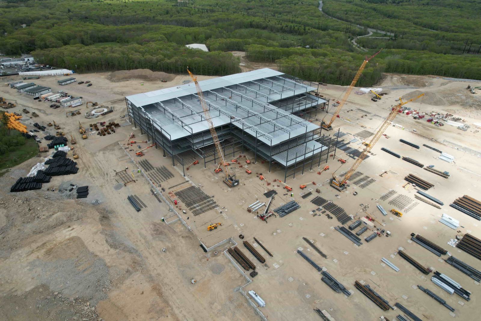
During the flight, the drone follows a predetermined path, often using automated flight planning software. This ensures consistent overlap and coverage. The pilot monitors the flight for safety and to handle any unexpected obstacles or changes in conditions. Weather, airspace restrictions, and battery life all factor into a successful mission. A good service provider has contingency plans for these variables. Once the drone lands safely, the data is transferred from the drone to a computer for processing. This transfer might happen via a direct cable connection, a removable memory card, or even cloud upload if the drone has cellular connectivity.
Processing: where raw data becomes usable information
Processing is the most technically demanding part of the workflow. For photogrammetry, software aligns overlapping images to create a single seamless orthomosaic. It uses the GPS metadata to position each image correctly and then blends them together. This process corrects for lens distortion, perspective, and terrain variation. The result is a geometrically accurate map that can be measured and compared over time. For 3D modeling, the software identifies common points in multiple images and reconstructs the surface as a point cloud or mesh. This model can then be used for volume calculations, slope analysis, or as a base for further design work.
For thermal data, the processing involves radiometric calibration. Raw thermal images contain temperature data, but it is stored in a way that needs conversion to meaningful values. The software applies the correct parameters based on the camera and environmental conditions, producing images where each pixel represents a specific temperature. These can then be analyzed to find hot spots or temperature anomalies. For LiDAR data, processing involves filtering out noise, classifying points (for example, separating ground from vegetation), and generating digital elevation models. Each sensor type has its own processing pipeline, and each requires expertise to produce reliable results.
Organizing and visualizing the results
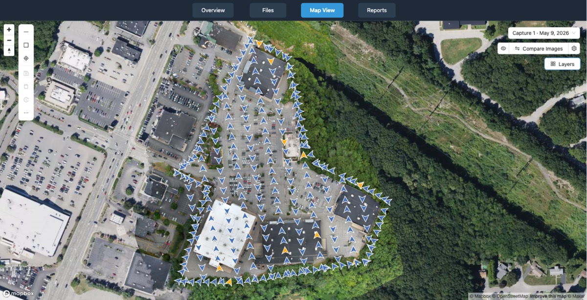
After processing, the data needs to be organized so the customer can easily find and use it. A good provider delivers a structured set of files, often with a clear naming convention and folder hierarchy. For large projects, this can include multiple flight dates, different sensor types, and various output formats. The customer might receive a web-based visualization that allows them to pan, zoom, and measure directly in a browser. This is far more convenient than trying to open huge files on a local computer. Platforms like those offered by National Drone Services are designed for exactly this purpose: uploading, processing, organizing, visualizing, comparing, measuring, and sharing drone aerial data. The phrase nationaldroneservices.net refers to a platform that handles these tasks, making it easier for professionals to manage their data without needing specialized software installed on every machine.
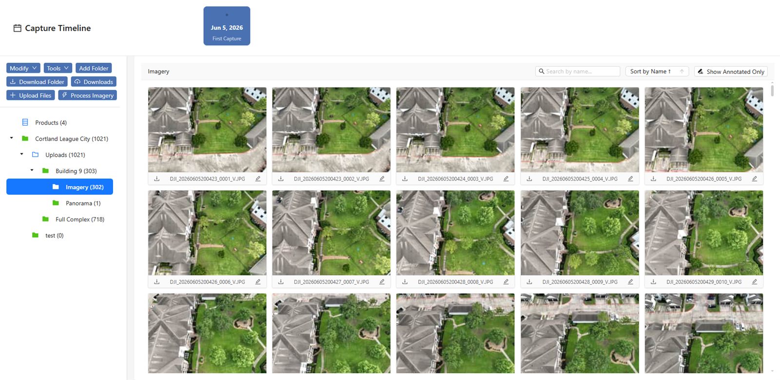
The ability to compare data over time is particularly valuable. A construction site that is photographed weekly can be overlaid to show progress. An agricultural field monitored throughout the growing season can reveal changes in plant health. An inspection site revisited annually can highlight developing issues before they become critical. The platform stores historical data alongside new captures, allowing side-by-side comparison or even automated change detection. This temporal analysis is one of the strongest arguments for using a full-service capture model, because the provider handles the alignment and processing that makes comparisons meaningful.
What this means for the customer
For someone who regularly needs aerial data, the full-service model reduces complexity and risk. They do not need to hire a drone pilot, buy processing software, or learn photogrammetry. They also avoid the capital expenditure of purchasing drones and sensors that might only be used occasionally. Instead, they pay for a service that delivers finished products. This can be more cost-effective, especially for organizations that need high-quality data but do not have the volume to justify an in-house operation. The trade-off is that they rely on the provider for quality and timeliness. Choosing a provider with a proven track record and transparent processes is therefore important.
The model also supports scalability. A single project might require one flight, or it might involve dozens of flights over a large area. The provider scales their resources accordingly. They can deploy multiple drones, use different sensors, and adjust flight plans to cover the area efficiently. The customer does not need to manage this logistics. They simply specify the area and the deliverables. This flexibility makes the full-service model suitable for everything from small roof inspections to large infrastructure surveys.
Choosing a provider and what to look for
When evaluating a full-service capture provider, several factors matter. First, the provider should clearly explain what they deliver and in what format. A written scope of work that specifies resolution, accuracy, file types, and turnaround time is essential. Second, the provider should have experience with the specific type of data needed. A provider who specializes in agricultural multispectral data may not be the best choice for a LiDAR survey of a forested area. Third, the provider should have a reliable data management and delivery system. Being able to access processed data through a web platform like the one at nationaldroneservices.net is a convenience that saves time and reduces the risk of data loss.
Another consideration is the provider's approach to quality control. Do they check for alignment errors? Do they validate the accuracy of measurements? A good provider will have internal checks and may provide a quality report with the deliverables. Finally, communication matters. The provider should be responsive to questions and willing to discuss the details of the flight plan and processing methods. A provider who treats the relationship as a partnership rather than a transaction is likely to deliver better results.
The journey from flight to delivery involves a series of specialized steps, each requiring knowledge and experience. A full-service capture model packages all of these steps into a single service, making professional aerial data accessible to a wider range of professionals. By understanding what happens behind the scenes, customers can make informed choices and get the most value from the data they receive.
National Drone Services on social media
 Facebook